Drought in the Colorado River Basin
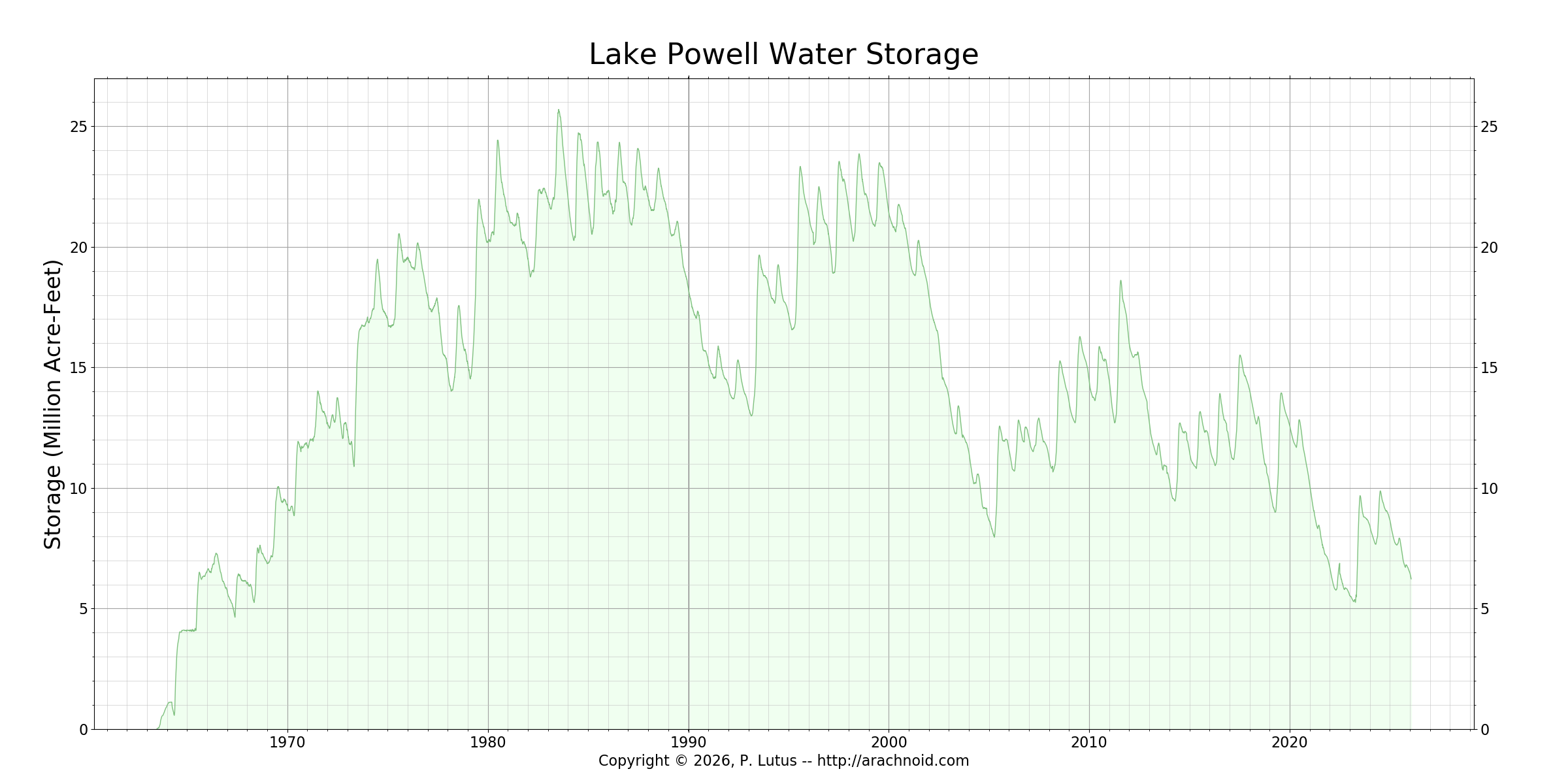
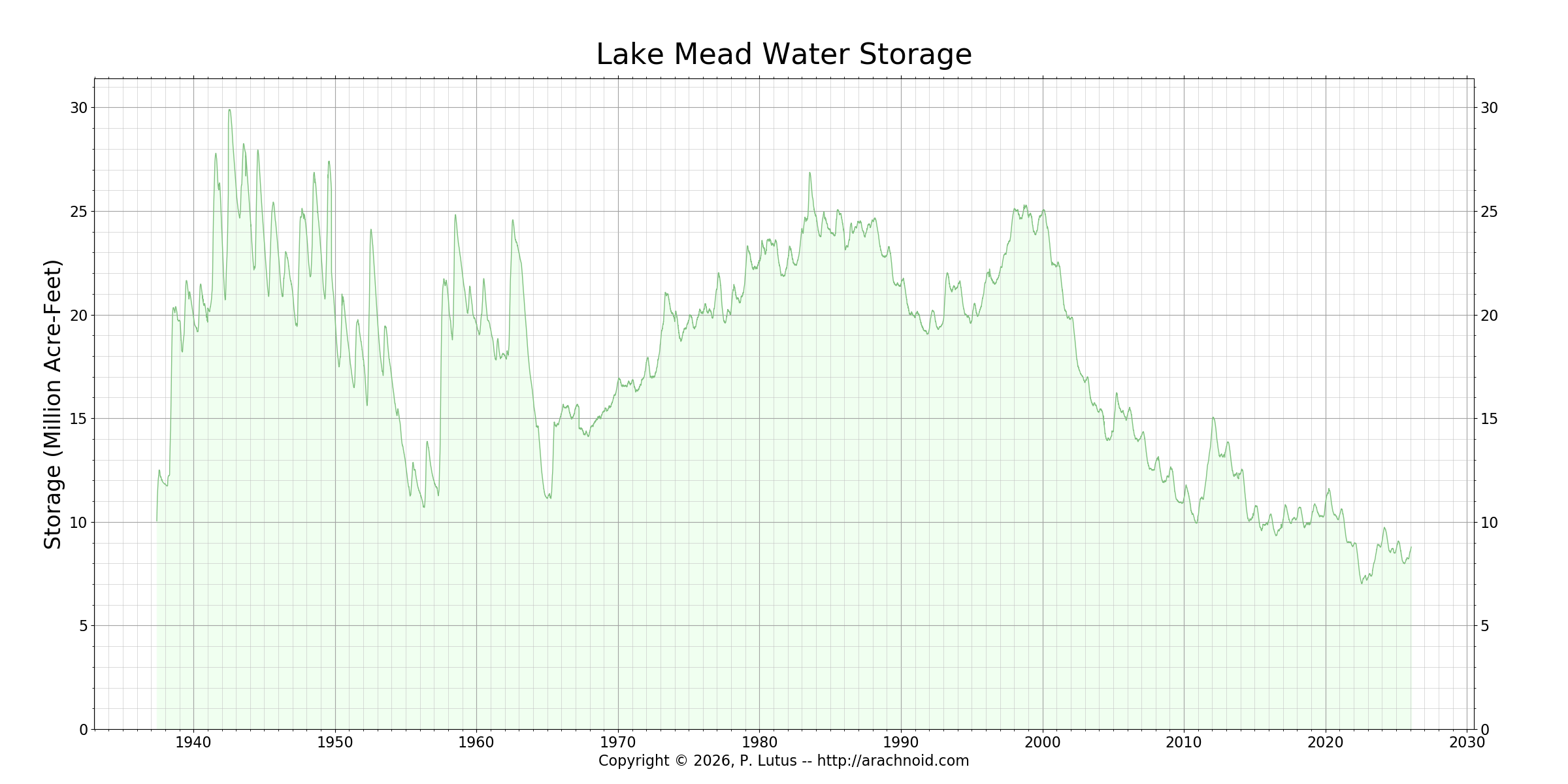
This 27-year mega-drought (as of 2026) is the worst drought in 1,200 years [NPR News]. The Ancestral Puebloans left the four corners area around 1,200 years ago, presumably because of a 50-year drought [Edwin Barnhart, PhD, Archaeologist, Maya Exploration Center]. The loss of water in Lake Powell and Lake Mead is significant, a combined loss of 13.73 trillion gallons. The declining elevations have been threatening to close the hydroelectric plants that supply electricity to millions of homes in the southwest, although, for the moment, that threat has lessened. These graphs show the declination of the contents of the lakes/reservoirs: Lake Powell - Lake Mead. These reservoirs, the two largest in the US, collect winter snowmelt in the spring to prevent flooding and to store water for summer useage.
The Colorado River Basin provides life-preserving water for 40 million residents in seven southwestern US States and two Mexican States in this arid desert.
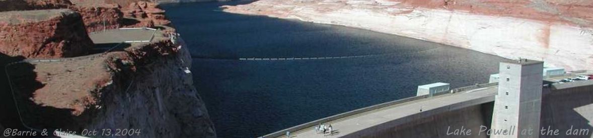
Lake Powell in the Glen Canyon National Recreation Area (GCNRA), created by Glen Canyon Dam, and Lake Mead in the Lake Mead National Recreation Area (LMNRA), created by Hoover Dam, provide a steady water supply throughout the Basin, and economical electricity.
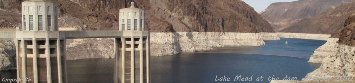
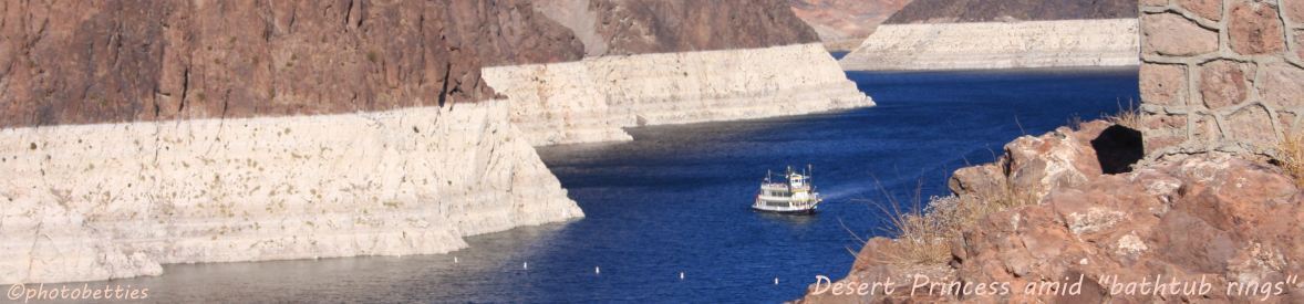
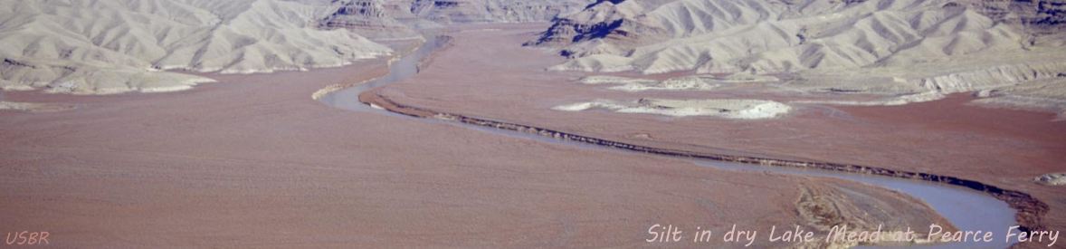
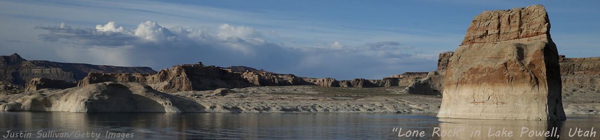
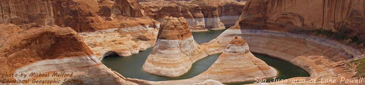
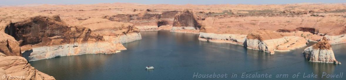
Cycling banner photos include Lake Powell at the dam, the San Juan Canyon arm of Lake Powell, a large houseboat in the Escalante Canyon arm of Lake Powell, Lake Mead at the dam, the Desert Princess paddlewheeler amid huge bathtub rings
near Hoover Dam, and silt in the dried-up eastern arm of Lake Mead where the Colorado enters LMNRA as it exits the Grand Canyon.
The Photo Gallery provides beautiful scenery (and a few sad images) of Lake Powell and Lake Mead in drought with bathtub rings.
Deposits of calcium carbonate and other hard minerals on the darker-colored surface of the sandstone is what causes this water-bleached effect which is observable when the water levels are down - dramatically during drought.
Some of the photos in the gallery come from the Glen Canyon NRA (Lake Powell) and Lake Mead NRA articles, which have additional information and photos that pertain to their recreation areas.
The photo gallery has an auto-show of the gallery photos.
Satellite images are Lake Powell and Lake Mead NASA satellite image overlays in an auto-show that illustrate the progression of the drought.
Drought defined discusses defining a drought, ultimately deferring to the National Drought Mitigation Center at the Unversity of Nebraska/Lincoln for our definition.
Basin drainage has a map of the drainage of the Colorado River Basin, with maps of the drainage basins of the three largest tributaries of the Colorado: Green River, San Juan River, and Gila River. Basin graphic is a graphical view of the Colorado River Basin.
Minute 319 & 323 provides information and photos on the historic agreements between the US and Mexico on the storage-and-release of Mexico's water allotment that allowed the Colorado River to reach the ocean (Gulf of California to the Pacific Ocean) in 2014 for the first time in 16 years.
It is feared that as climate change wreaks its havoc on the planet that this is the new normal, and that we are in for a challenging future.